

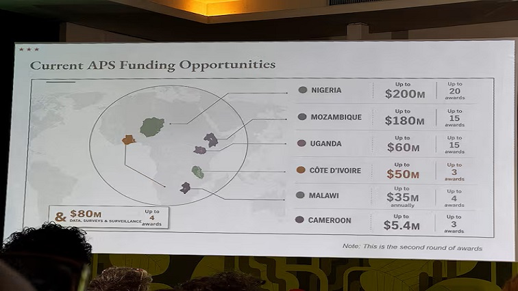
A United States (US) State Department presentation delivered at the AIDS 2026 conference in Rio de Janeiro, Brazil, has drawn widespread criticism after displaying a map of Africa that mislabelled every country on the continent.
The graphic was displayed during a session outlining new health agreements under the US President’s Emergency Plan for AIDS Relief before an audience that included senior officials and diplomats from several African nations.
The misrepresentations included placing Nigeria landlocked in the Sahara Desert, shifting Mozambique to the Horn of Africa, and positioning Ivory Coast on the eastern side of the continent.
A Reuters analysis of the presentation footage revealed an artificial intelligence (AI) watermark embedded in the map image, indicating it had been generated using OpenAI tools.
The US State Department accepted full responsibility for the error, stating that the slide was hastily produced and inserted by a team member shortly before the event took place.
–Reuters/ChannelAfrica–